
From LiDAR and images to a 3D CAD model.
Automatically generate a 3D CAD model from LiDAR data and images, then continue working in your CAD software. The solution prepares models of existing sites and equipment for technical planning.
- Who it helps
- Designers and contractors continuing work in their own CAD software.
- What you get
- An automatically generated 3D CAD model from LiDAR and images, with an agreed export.
- Example use
- Prepare an existing-site model for planning changes.
Explore the finished 3D CAD model.
Take a tour of a pumping-station model and see the pipework, valves, pumps and their layout within the room.
Compare the actual site with its 3D CAD model.
A pumping station from several viewpoints. The photograph shows the existing equipment; the CAD model represents its geometry for further planning and work in your CAD software.
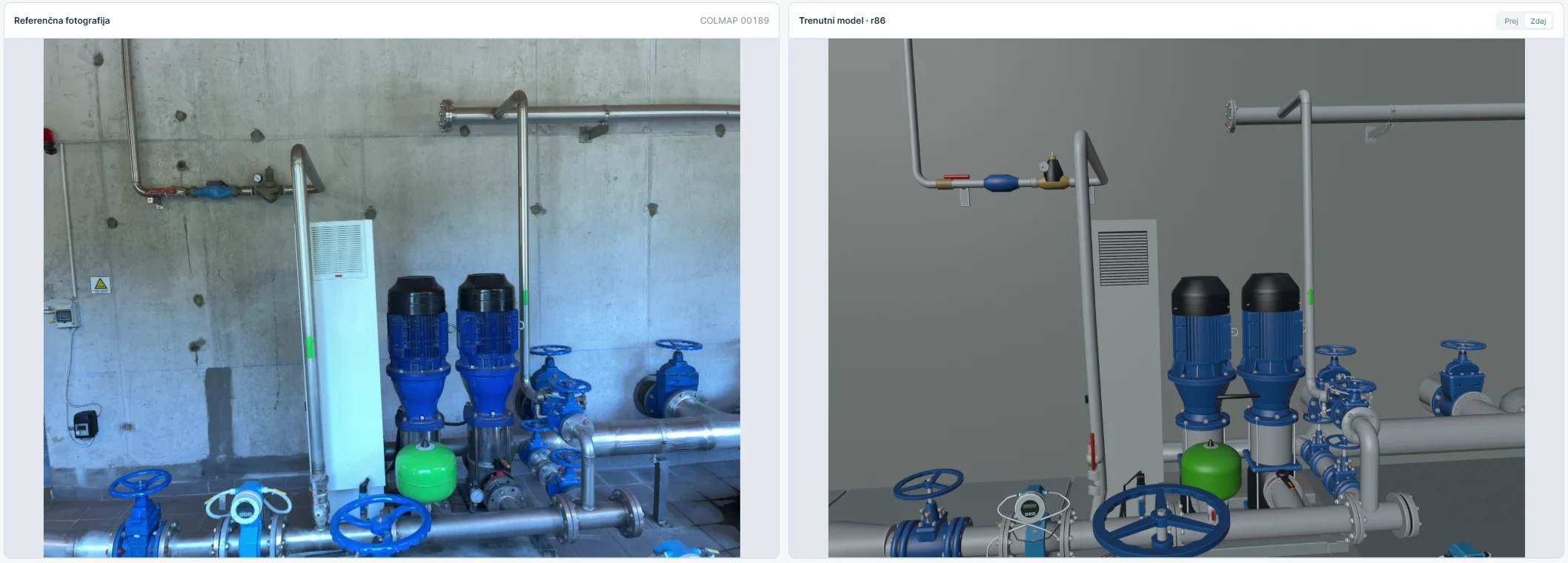
Pumps and connections
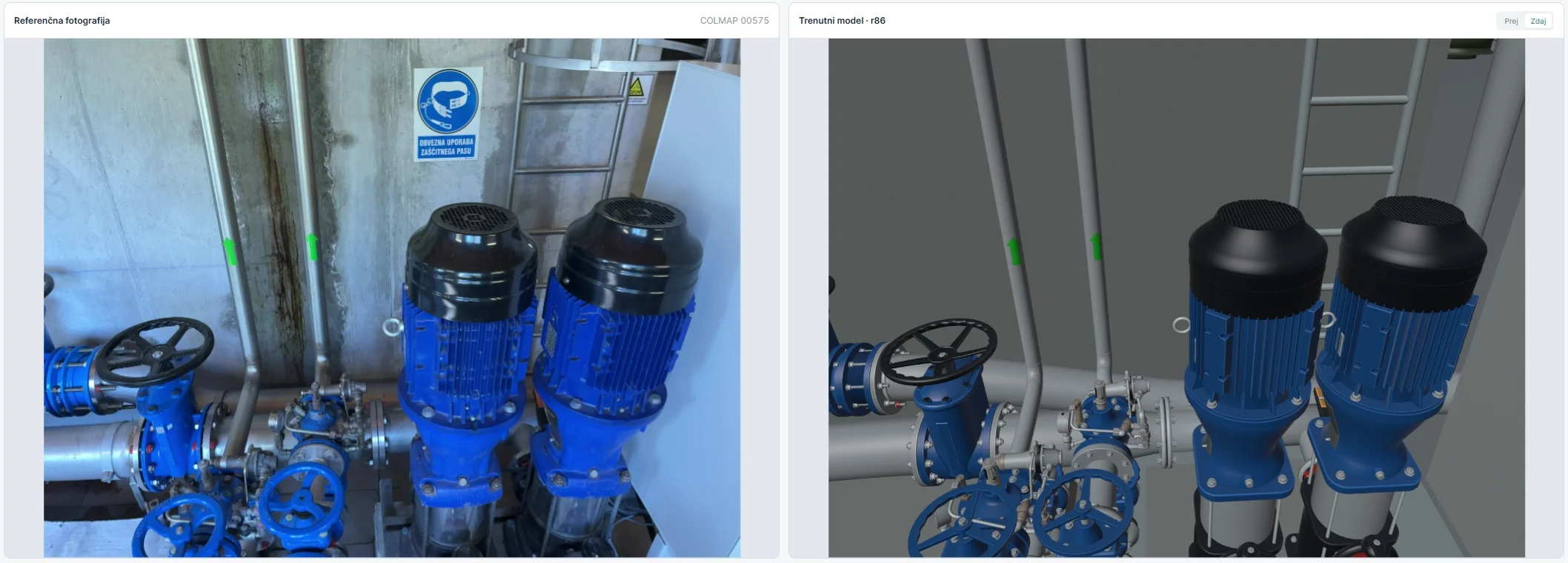
Pipework, valves and flanges
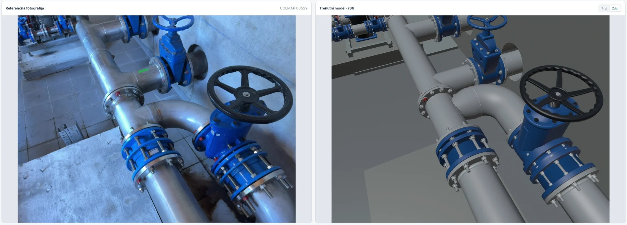
The room, equipment and control cabinets
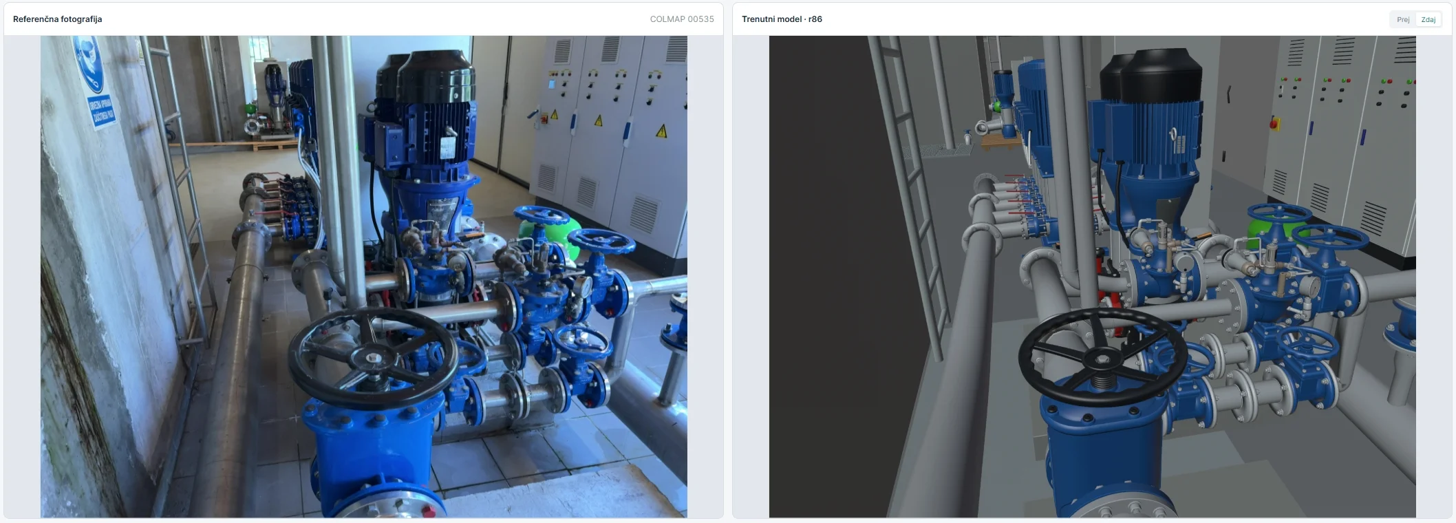
We agree the scope, model detail and required measurement accuracy for the intended use of your project.
Start with captured site data.
Use LiDAR data and images of the site or equipment. Before starting, we review available data, coverage and intended use. If you need a new LiDAR capture, our team carries out the scanning.
Generate the 3D CAD model automatically.
The input data is used to generate a 3D CAD model automatically. We define the modelling scope, required detail and accuracy for your project, then review the result against the agreed requirements.
Continue in your CAD software.
Export the completed model and import it into your CAD software for further work, design or inclusion in a project. We agree the output format for the tools you use so the model fits your workflow.
How do we get started?
- Define the site, intended use and CAD software you will use next.
- Review LiDAR data and images, then agree scope, requirements and price.
- Generate the model automatically, review the result and prepare the export in the agreed format.