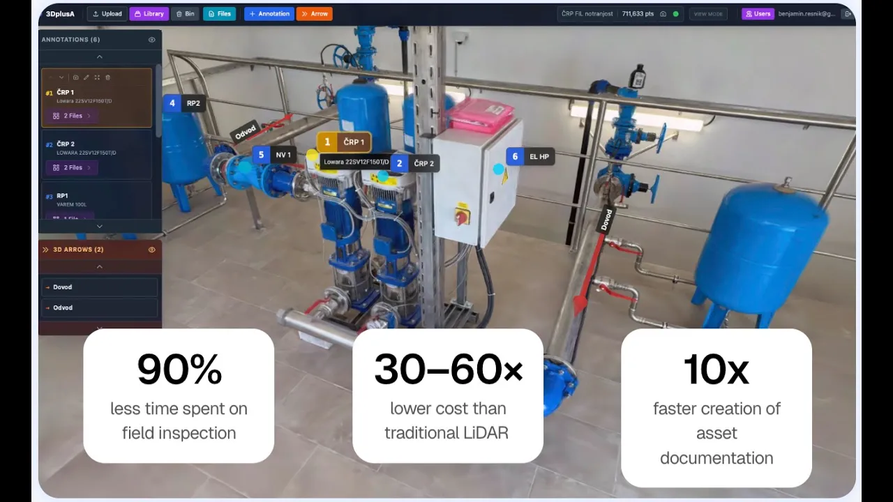
An AI-powered 3D asset management + SCADA + documents system for utilities
Access all assets, documents, and real-time sensor data in one highly detailed 3D digital environment—without field visits, expensive scanners, or complex software.
90%
less time spent on field inspection
30–60×
lower cost than traditional LiDAR
10x
faster digitalisation of assets

We are using the latest technologies


Photorealistic 3D digital twin
Detailed 3D models (captured with phone or drone) eliminate the need for on-site visits.

Live SCADA & IoT data overlay
We integrate live sensor data directly into the 3D model, connecting existing systems into a single, unified environment.

A built-in document and file system inside the 3D model
A single place for all latest data, images, and manuals to maximize efficiency.

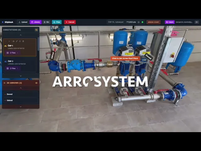
3D annotations, arrows, and collaboration
Designed to be easy for anyone to use and share.

Embedding via iframe into existing systems
Flexible and fully customizable—built to plug into your existing tools with minimal effort.

Private cloud and on-premise options
We support full on-premise installation for maximum data security.
Capture
Record a short video with a phone or drone. No expensive scanning hardware, no training.

Upload and process
AI transforms the video into a detailed 3D model with full visual context.

Use and share
View, annotate, add files, monitor, and share—directly in your browser.

Integrations


90%
less time spent on field inspection
30–60×
lower cost than LiDAR
10x
faster creation of asset documentation
A technician sees error 505 → searches the pump → gets manuals, past logs, location, and repair steps instantly.— Instant error resolution
Small model
100 €
100 €
/model
Input video up to 2min
200 €
300 €
/model
Input video up to 3 min
Large model
on demand
on demand
/model
Input video more than 3 minutes
Pricing for system
Storage, view, annotate, document system, live Scada, Iot, collaborate
What is 3DplusA?
3DplusA is an AI-powered SaaS platform for utilities that combines 3D digital twins, SCADA data, and documentation into a single browser-based system, enabling faster operations and fewer field visits.
Who is 3DplusA for?
Who in the organization uses 3DplusA?
How does 3DplusA work?
What are the benefits of 3DplusA for utilities?
What are the key features of 3DplusA?
Can I use my own drone? What do you recommend?
Do I need technical skills to use 3DplusA?
Do I need LiDAR or special hardware?
How long does it take to create a 3D model?
Can 3DplusA integrate with tools we already use?
Can it be used for remote or hard-to-access locations?
Is my data secure on 3DplusA?
What's the difference between LiDAR, photogrammetry and your solution?
Show more


Try live demo
Enter your name and email to try the live demo and test all functionalities.